TANGIER, Virginia – While Hurricane Imelda is currently impacting Bermuda and not making direct landfall in Virginia, Tangier Island residents should prepare for hazardous conditions as the storm churns up the Atlantic. Along with the remnants of former Hurricane Humberto, these systems are generating persistent northeast winds that will bring multiple rounds of tidal flooding to the community through the end of this week.
WHAT TO EXPECT TODAY AND TONIGHT
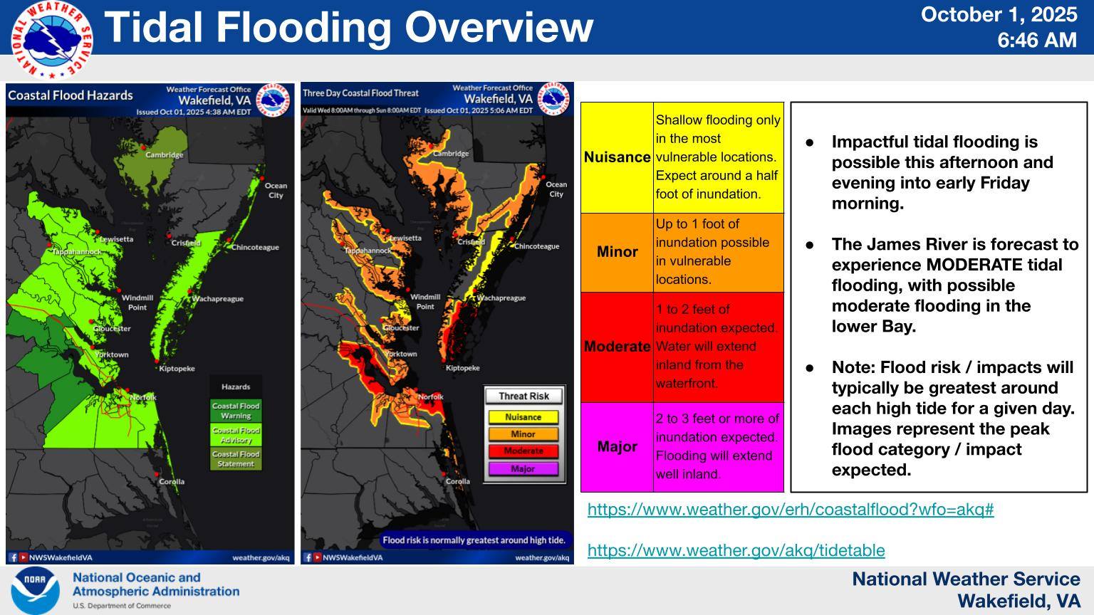
Tidal Flooding Advisory and Small Craft Advisory are in effect for Tangier Island.
High Tide Impacts – Wednesday, October 1
Morning High Tide (7:29 AM) – 2.7 feet
- Some tidal flooding expected on low-lying roads
- Tidal pooling in yards
- Minor flooding in vulnerable areas
Evening High Tide (8:07 PM) – 3.4 feet
- Moderate flooding expected
- Most low areas of West Ridge, Factory Road, and Wallace Road will be flooded
- School Lane and Parks Marina Lane will experience flooding
- Water inundation of 1-2 feet above ground level in vulnerable areas
Weather Conditions
Wednesday Daytime:
- Partly sunny with a high near 70°F
- Breezy northeast winds of 21-24 mph
- Wind gusts up to 33 mph
Wednesday Night:
- Mostly clear with temperatures around 62°F
- Breezy northeast winds of 17-21 mph
Sunrise and Sunset
- Sunrise: 6:59:59 AM
- Sunset: 6:46:58 PM
EXTENDED OUTLOOK: WEDNESDAY THROUGH FRIDAY
The persistent onshore northeast winds will continue to push water into the Chesapeake Bay, resulting in numerous rounds of tidal and coastal flooding from Wednesday through Friday. The lower Chesapeake Bay and tidal James River areas, including Tangier Island, face the greatest risk for moderate flooding during this period.
Additional concerns include:
- Large breaking waves
- Beach erosion
- Dangerous marine conditions
SAFETY RECOMMENDATIONS
For Residents:
- Secure loose outdoor items that could be carried away by floodwaters
- Stay informed about changing conditions throughout the week
- Be prepared for multiple flooding events over the next several days
For Mariners:
- Small Craft Advisory remains in effect
- Expect hazardous marine conditions with gusty winds and rough seas
- Life-threatening surf and rip current conditions are possible along coastal areas
STAY INFORMED
This is an evolving situation. Residents should continue monitoring updates from:
- US National Weather Service Wakefield, VA
- Virginia Department of Emergency Management
- Local Tangier Island officials
For the latest weather information and emergency alerts, please follow official emergency management channels.
Information provided by NOAA National Hurricane Center, US National Weather Service Wakefield VA, and Virginia Department of Emergency Management
